
HowHigh
Barometer and altimeter app for iPhone
A barometric altimeter for iPhone — track elevation gain and air pressure in real time.
HowHigh turns the barometric pressure sensor inside your iPhone or iPad into a live altimeter and barometer. Start a session, climb, and watch elevation gain, loss, and pressure trends chart themselves in real time — on a trail, in a stairwell, or anywhere a tape measure can't reach.
The problem
GPS can't tell you how high you climbed
GPS altitude is coarse — it can drift by tens of feet and needs a clear view of the sky. A tape measure tops out at a staircase. So when you want to know the elevation you gained on a hike, or roughly how tall that building or hill is, you end up guessing.
The fix
Your phone already has the right sensor
Modern iPhones carry a barometric pressure sensor that picks up the small pressure changes that come with changes in height. HowHigh reads it directly, converts pressure into elevation, and records the whole climb as a session you can scrub through afterwards. No GPS fix, no network required.
Features
What it does
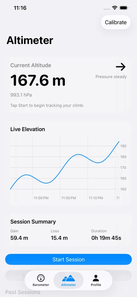
Live altimeter
See your current altitude and the direction it's moving, straight from the barometer.
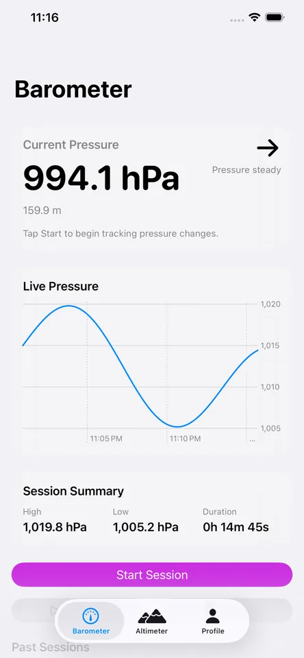
Live barometer
Watch air pressure in real time with a trend indicator — useful for weather watching too.
Session recording
Record a climb and get a summary of elevation gain, loss, and duration you can replay later.
Interactive charts
Scrub through pressure and elevation graphs to see exactly when and how much you climbed.
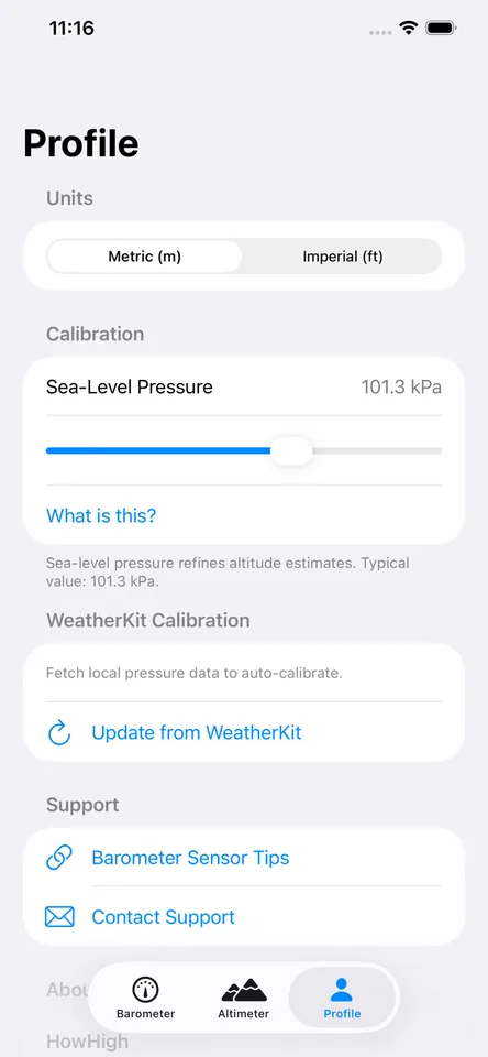
Calibration built in
Dial in sea-level pressure by hand or auto-calibrate from local weather data via WeatherKit.
Metric or imperial
Switch between meters and feet, hPa and kPa, with a tap.
In the app
Screens
Use cases
Where it fits
Elevation gain on a hike
Start a session at the trailhead and see your total gain, loss, and time when you reach the top.
How tall is this thing?
Ride or walk from the bottom of a building, tower, or hill to the top — the session gain is its height, no tape measure involved.
Watching the weather
Falling pressure often means weather is coming. Keep an eye on the live barometer and its trend.
Compared
Other ways people measure height
| The alternative | Why it falls short | How HowHigh helps |
|---|---|---|
| GPS elevation apps | GPS altitude is the least accurate part of a GPS fix — it drifts, lags, and fails indoors. | The barometer responds to small changes in height instantly and works indoors, in tunnels, and offline. |
| Guessing from floor counts | Multiplying floors by an assumed ceiling height is a rough estimate at best. | HowHigh measures the actual pressure change of your climb and reports it in feet or meters. |
| Laser distance measures | They need a clear line of sight to the top and are hardware you have to buy and carry. | Your phone is already in your pocket, and it measures the path you actually travel — including trails. |
FAQ
Frequently asked questions
Is HowHigh free?
Yes. HowHigh is free on the App Store.
Does HowHigh need GPS or an internet connection?
No. Readings come from the barometric sensor in your device, so the altimeter and barometer work fully offline. The optional WeatherKit calibration fetches local pressure data and does use the internet.
Which devices does it work on?
iPhone and iPad models with a built-in barometric pressure sensor, running iOS 16 or later.
How accurate is a barometric altimeter?
Barometric sensors are very sensitive to changes in height, which makes them well suited to measuring gain and loss during a climb. Absolute altitude depends on current sea-level pressure, so HowHigh lets you calibrate it manually or from local weather data.
Can I measure the height of a building with my iPhone?
Yes. Start a session at the bottom, travel to the top, and the session summary shows the elevation you gained — that's the height you climbed.
Where is my data stored?
Recorded sessions stay on your device until you choose to share or export them. No account is required.
Know exactly how high
Free on the App Store. Start a session and let the sensor do the measuring.